
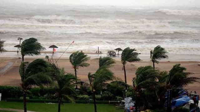
Cyclonic storm Vardah has now turned into a severe cyclonic storm and is likely to make landfall by Monday afternoon along north Tamil Nadu and south Andhra Pradesh coast, close to Chennai, according to the India Meteorological Department.
The landfall will be accompanied by strong winds at the speed of 80 to 90 kmph and heavey to very heavy rainfall, an IMD release said
Tidal waves likely to inundate the low lying areas of Chennai, Tiruvallur and Kanchipuram districts of Tamil Nadu; and Nellore district of Andhra Pradesh.
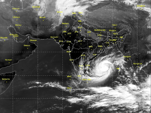
The IMD has predicted isolated heavy to very heavy falls over south coastal Andhra Pradesh, north coastal Tamil Nadu and Puducherry during the next 36 hours.
The rainfall intensity will increase gradually becoming heavy to very heavy rainfall (7-19 cm) at a few places and isolated extremely heavy rainfall (≥ 20 cm) over Chennai, Thiruvallur and Kanchipuram districts of Tamil Nadu and Nellore and Prakasam districts of Andhra Pradesh on Monday.
who named the cyclone as Vardah? It is Pakistan. ’Vardah’, which means ‘red rose’.
Name of cyclones in the Indian Ocean Region are decided by member countries — India, Sri Lanka, Bangladesh, Thailand, Myanmar, Maldives and Oman. The last cyclone was ‘Nada’, a name suggested by Oman.
The Centre has dispatched NDRF personnel to Tamil Nadu and Andhra Pradesh.
One team of NDRF comprising around 40 personnel has been pre-positioned in Andhra Pradesh’s Nellore, one in Tada, one in Sulurpeta, one in Ongle, and one in Chitpore district.
In addition, another team is moving to Sulurpeta while teams are on standby in Guntur and Hyderabad.
Three NDRF teams were pre-positioned in Chennai, two in Tamil Nadu’s in Thiruvallur, one in Mahabalipuram. Sources said another team is on its way to Chennai while one team has been out on stand by at Arakkonam.


